Anak Krakatau aka Krakatoa Volcano
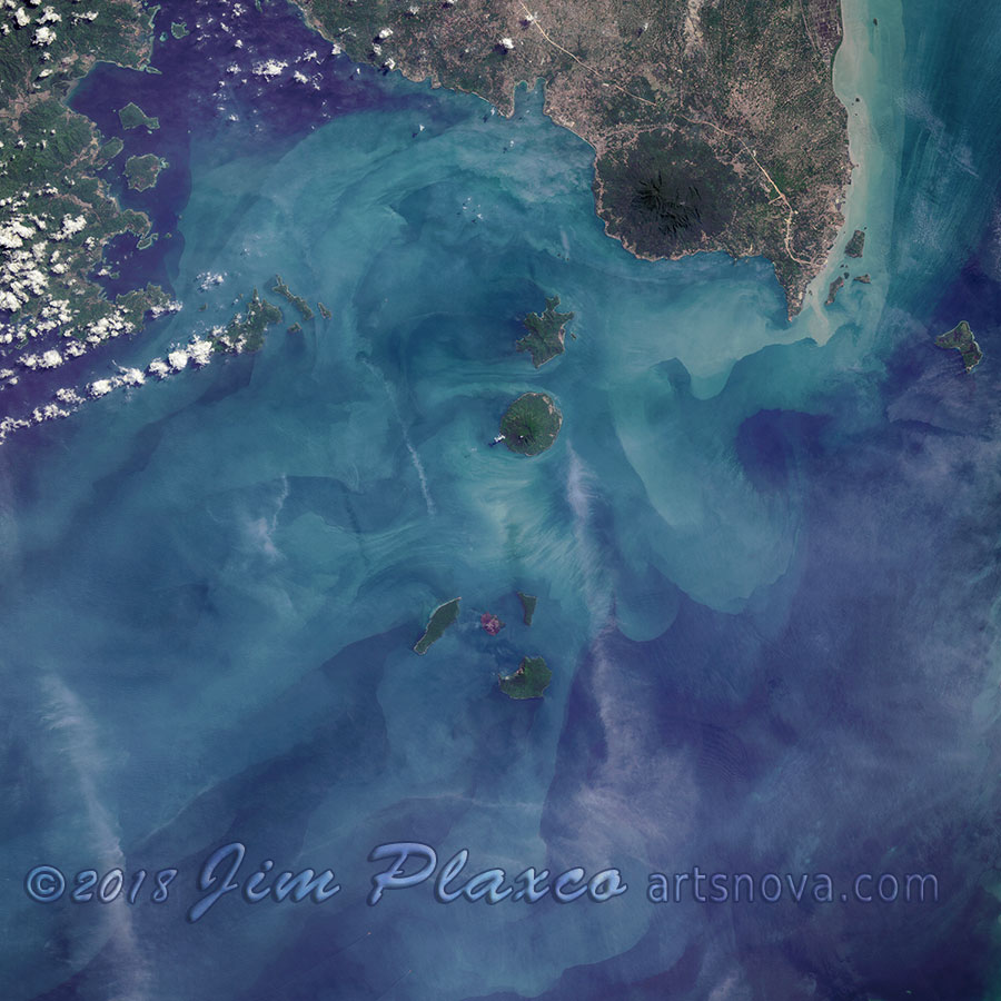
Landsat image of Krakatau Volcano
I'm not sure what possessed me to seek out a Landsat image of Anak Krakatau (aka the Krakatoa Volcano) at this time – but I did. In my presentation Planet Earth As Art: The View From Space I do include images of several volcanoes so perhaps adding Krakatau was in the back of my mind. Whatever the reason, the Anak Krakatau Volcano is the latest addition to my Planet Earth Satellite Imagery Gallery on Redbubble.
In processing the raw Landsat image files (separate 16-bit black and white images for the red, green, and blue channels along with the panchromatic image for luminosity), I employed a work flow that had a number of differences from work flows I've previously used to process satellite images. Of course I tend to employ a slightly different work flow with every satellite remote sensing image I process since I have no interest in creating a workflow “recipe” and don't bother to document the processing steps I do take.
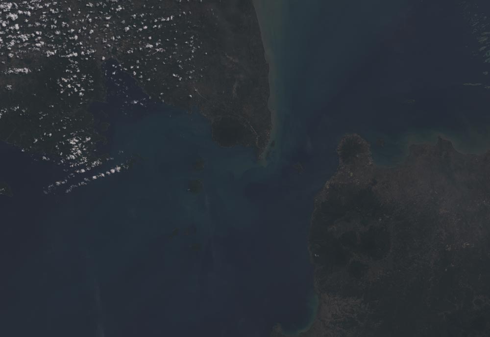
Krakatau (Krakatoa) Original (Non-Processed) Landsat Red, Green, Blue, Panchromatic Images Stacked
The challenge with this particular image was to visually magnify the contrast of the waters of the Sunda Strait and to brighten the image without blowing out the cloud details. Unfortunately since I kept no notes as to the specific steps I took to get from the raw input to the final output I can't precisely recreate what I did. This is unfortunate because the results turned out better than I had expected.
Enough about the image processing – it's time to talk about the volcano and the major features in the image. For reference purposes, use the following map to identify key features in the image.
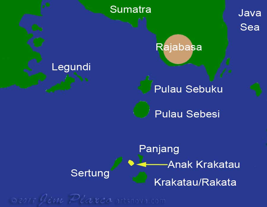
Map of the region of Krakatau Volcano in Indonesia south of Sumatra
Rajabasa is an isolated 1280 meter high stratovolcano located at the southeastern coast of the island of Sumatra. The summit crater is approximately 600 meters in diameter. It is not known when this ancient volcano last erupted.
Sebuku is a low lying island in the eastern part of Lampung Bay and is only 2.5 kilometers north of Sebesi island. Sebuku is also of volcanic origin and probably dates to the Quaternary – the most recent period in the Cenozoic era.
Sebesi is about 12 kilometers north of the Krakatoa islands. While it is volcanic, there are no known dated eruptions. Inhabited at the time of the 1883 eruption of Krakatau, estimates are that some 3,000 people on the island lost their lives as a consequence of that eruption.
Sertung, also known as Verlaten, is another volcanic island a mere 2 kilometers west of Anak Krakatau. Unlike the island of Krakatau which lost about two-thirds of its area in the cataclysmic 1883 eruption, Sertung temporarily tripled in size due to the volcanic fallout (pumice) from the eruption but much of that gain quickly eroded away.
Panjang, also known as Lang and as Pulau Krakatau Kitjil, is the small island about 2 kilometers east of Anak Krakatau.
Krakatau and Rakata are the remains of the original island of Krakatau which was destroyed by the 1883 eruption. Rakata itself is one of the three volcanoes that made up the island of Krakatau – the other two having been destroyed during the 1883 eruption.
Collectively Sertung, Panjang and Rakata represent the boundaries of the large submarine volcanic caldera which is almost 8 kilometers in diameter.
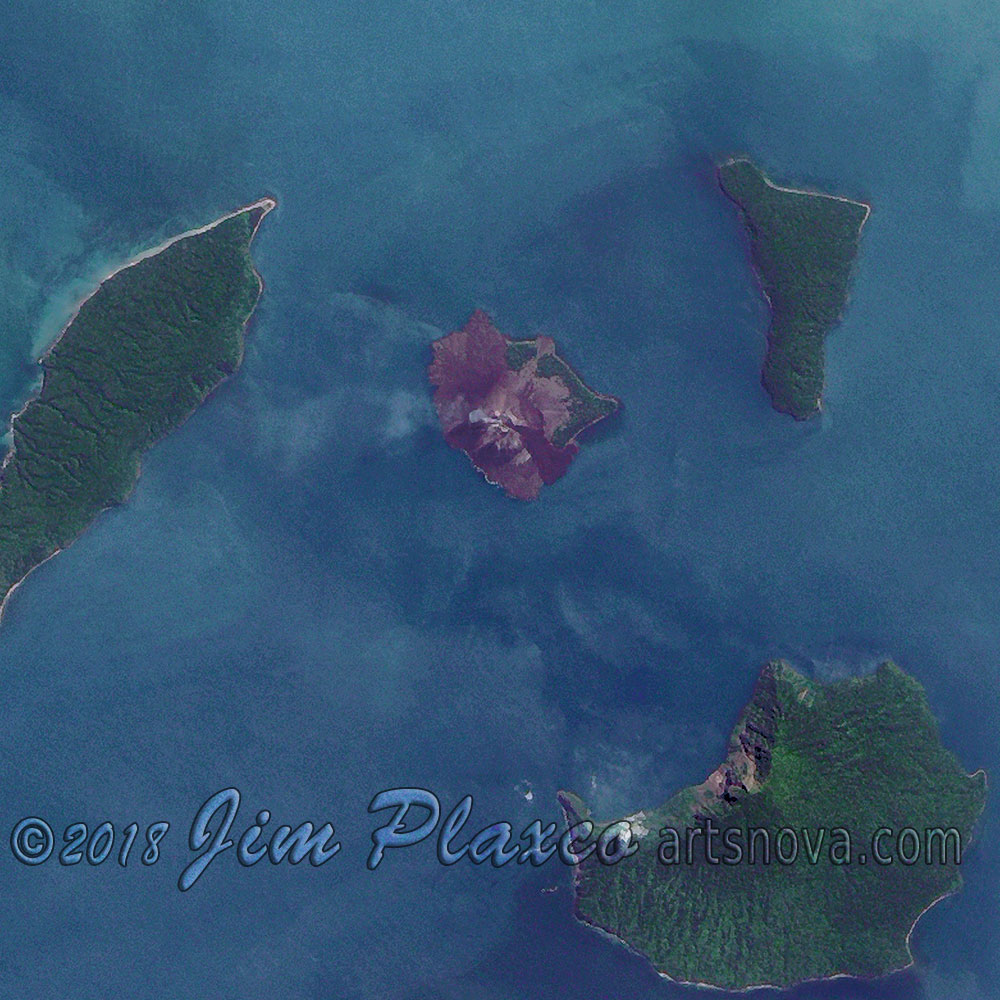
Anak Krakatau (Krakatoa) Volcano – full size image detail
Anak Krakatau (Child of Krakatoa) is a new island that emerged in 1930 following submarine volcanic eruptions and represents the center of volcanic activity for Krakatau/Krakatoa. As of 2017, Anak Krakatau's height was over 400 meters above sea level.
The eruption of Krakatoa in 1883 was one of the most powerful eruptions in recorded history. The energy released in the eruption is estimated to have been on the order of 200 megatons of TNT, which is approximately equal to about 13,000 Hiroshima atomic bombs. The eruption also impacted global climate, causing an estimated one degree Celsius decline in the Earth's average temperature in the year that followed – with global temperatures not getting back to normal until 1888.
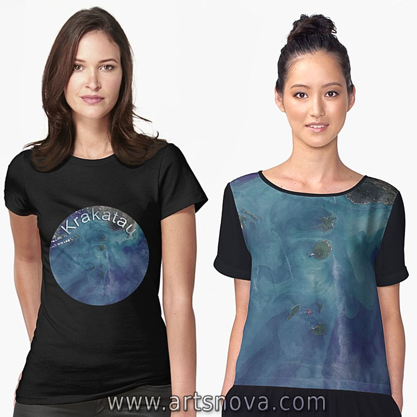
If you are a fan of geology, volcanoes in general or Krakatoa in particular, I have made this image of Krakatau available on a number of products in my art gallery on Redbubble. Click either the button or image below for additional product information.
Anak Krakatau (aka Krakatoa) Volcano on Redbubble
| Return to the Blog Index | This entry was posted on Thursday, June 7th, 2018 at 7:48 am and is filed under Planet Earth As Art.