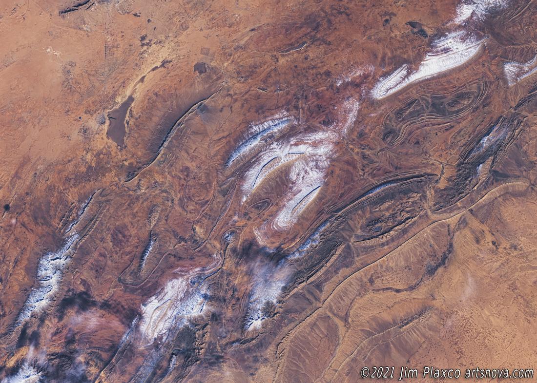
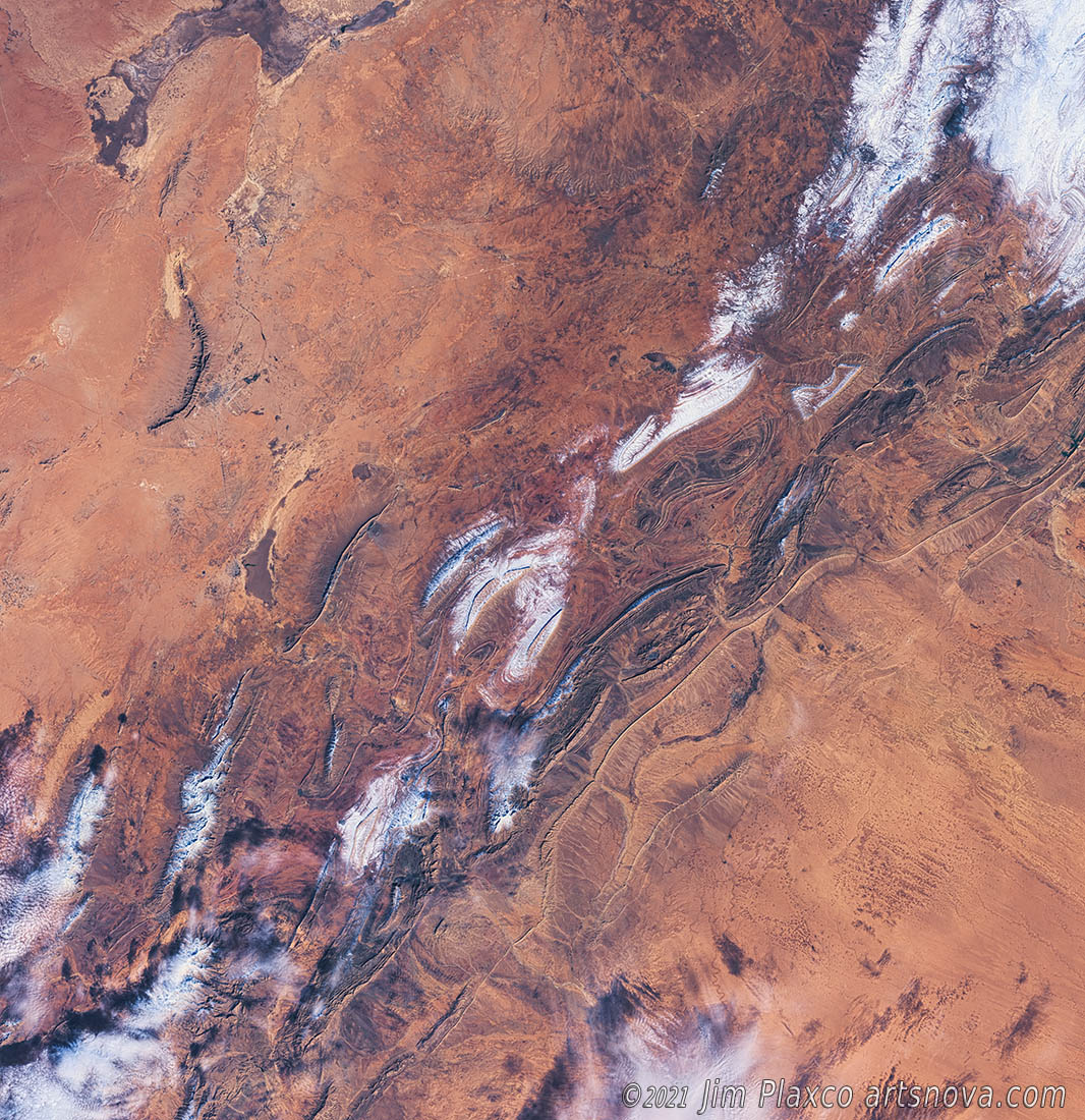
Satellite Image of Snow in the Sahara Desert, Algeria
Satellite Image of Snow in the Sahara Desert, Algeria is an image processed Landsat 8 remote sensing image created as a part of my Earth As Art project. The Landsat satellite captured this scene on Jan 8 2018. It is estimated that the snow accumulation seen in this picture ranges from 4 to 12 inches. Given the environment, snow is a very short lived phenomena in the Sahara and this snow would have melted fairly quickly. To locate the scene on a map, the town of Aïn Séfra is visible in the image.
Image processing techniques used in the creation of this version of the Landsat scene includes panchromatic sharpening, contrast enhancement, color enhancement and brightness adjustments. The image shown here is a cropped version of the original. Whereas this image is 36x24 inches when printed at 300ppi (pixels per inch), the full size of the image as I processed it is 84x87 inches at 300 ppi.
| Title: | Satellite Image of Snow in the Sahara Desert, Algeria |
| Classification: | earthart |
| Image Size: | 36 inches wide by 24 inches high |
| Media/Papers: | Fine Art Paper, Canvas, Metal |
| Editions: | Ask |
| Availability | Ask |
| Price | Ask |
See this artwork on Society6: Satellite Image of Snow in the Sahara Desert, Algeria on Society6
To inquire about the availability and price of a signed and framed print or for information about licensing, please use the Artsnova Contact Form.